VILLA RICA · WORK & DOWNTOWN
Before the music at Villa Rica’s MILL
At The MILL in downtown Villa Rica, people gather for music where a working complex once handled cotton and housed industry. That earlier life gives the name above the stage more meaning. [1] [4]
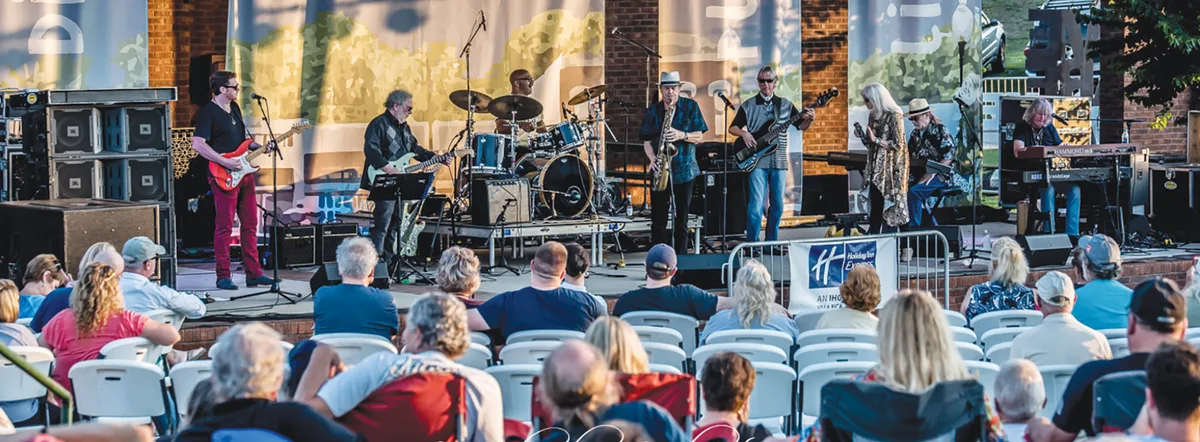
Villa Rica lies east of Temple along the railroad corridor through West Georgia. Its downtown story reaches beyond the gold mining for which the town is often remembered. Around the depot, warehouses and factories connected the surrounding countryside with markets farther away. [2]
In this story
Cotton needed somewhere to wait
The city’s historical marker places the Villa Rica Cotton Oil Mill complex here by 1900, with brick warehouses holding bales from an on-site gin. [1]
The wider district had commercial warehouses serving the same practical need: storage close to rail transportation. The National Register nomination describes broad, arched entrances through which wagons and small trucks could load or unload cotton. Even the Masonic Lodge used its ground floor as a cotton warehouse, with lodge activities upstairs. [2]
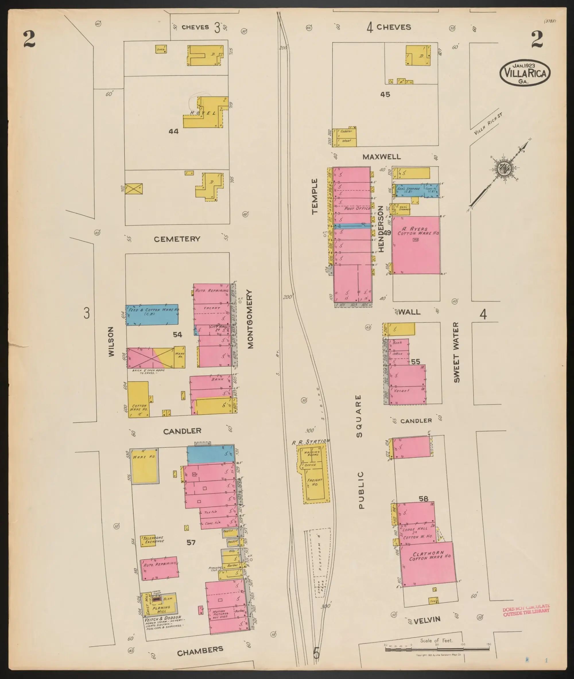
A January 1923 fire-insurance map makes that relationship visible. On sheet 2, the railroad runs through the middle of the business district. The station stands beside an area labeled Public Square. Cotton warehouses appear among shops and other buildings on both sides of the tracks. Near the bottom right, the map names the Clopton Cotton Warehouse; farther up, it identifies A. Ayers’s cotton warehouse. [3]
Follow the track with your finger, then look at how little distance separates the station from those buildings. The map helps explain why this part of town developed as it did. It records the surrounding business district, rather than marking the boundaries of today’s amphitheater. [3]
Lights, ice and bottles
According to the city marker, the Villa Rica Electric Light and Power Company occupied part of the complex in 1902. Ice production and Coca-Cola bottling followed; fertilizer manufacturing joined them in 1908. [1]
The marker preserves a detail worth looking for in a family collection: early cola bottles carried the electric light company’s name. That bottle connects two businesses a visitor might never expect to find in the same story. [1]
The hosiery years
The marker carries the story into hosiery production by 1927 and names Rica Tex, Golden City and Vince among the mill businesses associated with the site. [1]
Elsewhere in the same downtown district, the National Register nomination describes Golden City’s 1929 building at 135 Temple Street and another Golden City building on Main Street. Large factory windows helped distinguish these industrial buildings from the smaller storefronts around them. [2]
Those records give us buildings and company names. They leave much of the working day to be recovered: who learned which job, how families arranged their lives around a shift, and what people remembered after a mill changed hands. A dated photograph, a pay envelope or a carefully identified family account could help put names beside the buildings.
A different reason to come downtown
The city marker records Villa Rica’s purchase of the property in 2006. [1]
Today, the Convention & Visitors Bureau lists The MILL at 106 Temple Street as a downtown venue for concerts, festivals and other events, within walking distance of shops and places to eat. Check the official events calendar for a particular date before making plans. [4]
The old map offers a useful way to look around when you are there: notice the tracks, the size of the buildings and the short distances between them. Then look at the people gathering for the music. The place has changed its work, but it still gives people a reason to come into town.
Sources and research notes
This is a record-based account, not a report of a new visit or interview. The city marker summarizes a changing complex; it is not a complete company genealogy. The 1923 map illustrates the surrounding district, and the National Register nomination describes more than one mill property. Individual workers’ experiences and a detailed building-by-building timeline remain subjects for further reporting.
- City of Villa Rica, “The Mill” historical marker
Municipal marker text, reproduced with photographs by the Historical Marker Database. Used for the complex’s sequence of businesses and the 2006 city purchase. Marker photographs are not reproduced here. - North Villa Rica Commercial Historic District, National Register nomination
Sections 7 and 8 describe commercial cotton warehouses, the Masonic Lodge and Golden City buildings. Its descriptions of tenants and building condition belong to the nomination period, not a new inspection. - Sanborn Map Company, Villa Rica, January 1923
Sheet 2 was visually examined for the station, Public Square, warehouse labels and their relationship to the tracks. Held by the University of Georgia Map and Government Information Library; the archive identifies the map as No Copyright—United States. - Villa Rica Convention & Visitors Bureau, Things to Do
Official listing for The MILL, its downtown location and present uses. Reviewed November 15, 2026; this article does not promise a particular event or opening time.
Know someone who would enjoy this? Pass it along.