TALLAPOOSA · PEOPLE & PLACE
Before the Highway: How People Reached Tallapoosa
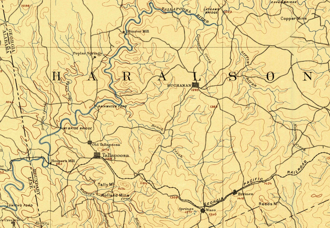
An 1889 map follows Tallapoosa’s railroad, country roads, river crossings and mills—and the connections promoters hoped to build.
On an 1889 map of Haralson County, Tallapoosa appears twice.
“Old Tallapoosa” sits north of the place labeled simply “Tallapoosa.” Through that second settlement runs the Georgia Pacific Railroad. Follow its tracks east and you reach Waco and Bremen. Follow the river instead and a different set of names comes into view: bridges, a ford, springs, and mills.
A route to the wider world
The Georgia Pacific’s through route between Atlanta and Birmingham opened in November 1883. Tallapoosa stood along that corridor, giving the town a connection to two cities and the markets beyond them.
An 1885 Georgia Department of Agriculture report makes the route recognizable. Its station list runs from Atlanta through places including Austell, Douglasville, Villa Rica, Temple, Bremen, Waco, and Tallapoosa.
That mattered to more than travelers. For a town seeking factories and new residents, transportation helped answer practical questions: How would supplies arrive? How would finished goods leave? How could a visitor reach a hotel in a town they had only read about?
The journey before the train
A railway station could connect a community to distant markets, but people still needed ways to reach it from farms, mills, and homes.
The map names McBride Bridge northwest of Old Tallapoosa and Rainwater Ford farther upstream. A ford is a shallow place where a road crosses through the water rather than over it. Hooper’s Mill, Munroe Mill, and Poplar Springs are also marked.
These crossings give us specific places to investigate. High water could interrupt hauling even where a building survived. Whether a particular flood closed a local mill, however, requires dated records of damage and business activity; the map alone cannot answer that question.
The connection people hoped would come
Tallapoosa’s promoters wanted more connections. The town’s National Register nomination describes a proposed Georgia, Tennessee & Illinois railroad toward Stevenson, Alabama. It also explains that the north–south railroad junction went to Bremen rather than Tallapoosa.
A junction is where railway routes meet. Another line could mean more directions of travel and more opportunities to handle freight. That helps explain why the prospect attracted promoters and investors.
A proposed line was still a promise. To understand the boom, we have to distinguish the connections people could use from those they were being offered.
Reading the landscape again
The map’s surveys date to 1886–1887, before some later boom developments. It cannot tell us every passenger’s fare or a bridge’s condition after a storm.
But it gives us names and locations to follow. Before asking why a business disappeared, we can ask how people reached it—and how its goods reached the rest of the world.
Sources behind the transportation story
- USGS Tallapoosa, Georgia–Alabama, 1889, scale 1:125,000, surveyed 1886–1887. “Munroe Mill” follows the map’s spelling. These old crossings have not been matched conclusively to surviving structures.
- Steve Storey, Georgia Pacific Railway. November 1883 refers to the Atlanta–Birmingham through route.
- Georgia Department of Agriculture, The Commonwealth of Georgia (1885), printed page 28, station sequence.
- Tallapoosa Commercial Historic District nomination, historical narrative: the junction, development promotion and proposed railway.
Historic names do not establish present-day public access. The old roads have not yet been aligned precisely with today’s roads.
Read another local story
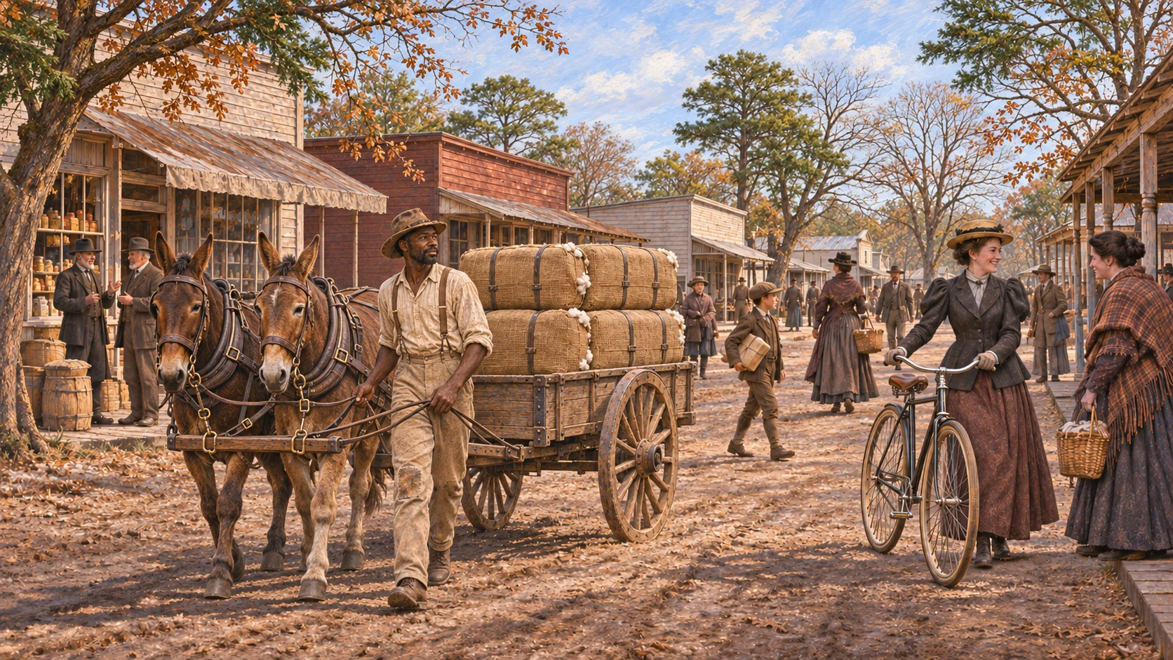 Christmas in Tallapoosa, Through a Visitor’s EyesHistorical reconstruction inspired by Nellie Warren’s 1900 account; people and architecture illustrative.
 Tallapoosa’s hotel above the quiet springsRemastered from a print supplied by Jackie Jones’s family. Colors and fine details interpreted; original artist/date unconfirmed.
What story should we tell next?
Is there a person, place or piece of local history you’d like to see on Moss & Sons? Perhaps your family has photographs, letters, an old business record—or a memory you’d like to share.
You don’t need to have the whole story. Tell us what you know, and we can start there. Daniel reviews contributions and confirms permission before anything is published.
Know someone who would enjoy this? Pass it along.