Haralson County · Family memory and a proposed lake
Our Bridge in the Survey Book
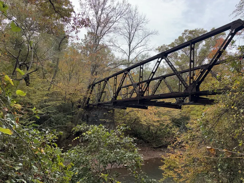
Beside Bethlehem Baptist Church in Haralson County, an old steel bridge crosses our stretch of the Tallapoosa River. I knew it as part of our family’s landscape. There is a photograph of me standing in the river with my boys, the steelwork above us and the water around our legs.
Then, while following the history of Bethlehem Church and the old crossings nearby, we found it in a very different setting: a report prepared for a proposed reservoir.
In the survey book, it had a number: Structure 21.
A familiar bridge, an unfamiliar photograph
Thomas H. Gresham’s 1990 Cultural Resources Survey of the Proposed West Georgia Regional Reservoir survives in the University of Georgia’s archaeological report collection. Near the back, a photograph looks along two low-sided steel spans. Much of the wooden roadway is missing, exposing the framework underneath. People are visible among the steelwork. [1]
I recognized the bridge as ours.
That recognition has more behind it than a familiar shape. The survey’s description and recorded position also fit the crossing beside Bethlehem Church Road. Table 10 calls Structure 21 a small bridge and marks it inside the proposed flood pool—the area expected to be covered by the planned reservoir. [1]
The old picture gives us something an aerial map cannot: a view through the bridge itself, with the steel standing and large gaps already in its deck. It is a record of the crossing’s condition at the time of the survey, even though the photograph does not identify the people or explain how the boards were lost.
Why anyone was recording it
The proposed lake brought researchers into the valley to identify what the project might affect. Southeastern Archeological Services carried out the fieldwork between February 5 and April 3, 1990. The report was prepared to support a Georgia Department of Natural Resources permit application to the U.S. Army Corps of Engineers. [2]
They were looking beyond the river channel. Their work recorded 242 archaeological sites and 22 standing historic structures across the study area. Houses, farmsteads, barns, a church and two bridges were part of the landscape they examined. The survey recorded a landscape of homes, work and earlier settlement before a final reservoir design had been settled. [2]
For our bridge, the table’s little “yes” under the flood-pool heading changes the way I read the photograph. The crossing was being recorded in connection with a plan that could have put water over it. Today, my family’s photograph shows the river still flowing beneath the steel.
The history a photograph cannot settle
The survey gives us a useful dated record, but it does not settle the bridge’s whole story. We still need the county or engineering files that establish when this steelwork was built, who supplied it and when the crossing closed to road traffic. The missing boards alone do not tell us the cause of the damage. [1]
It also matters which bridge we mean. The same report lists Mize Bridge separately as Structure 15. Its history cannot simply be attached to Structure 21 because both crossed the Tallapoosa. Old road names, moved spans and changing routes make these distinctions worth keeping.
From the survey book back to the river
The bridge is one way into a much larger story. Up the hill is Bethlehem Church, where newspaper notices preserve the names of Sunday-school officers and people gathering for worship. Elsewhere along the river, old mill places survive in road names, foundations and memories.
Those places deserve their own stories. This one begins with a simpler discovery: a crossing I knew through family life had also become a numbered entry in a study of the valley’s possible future.
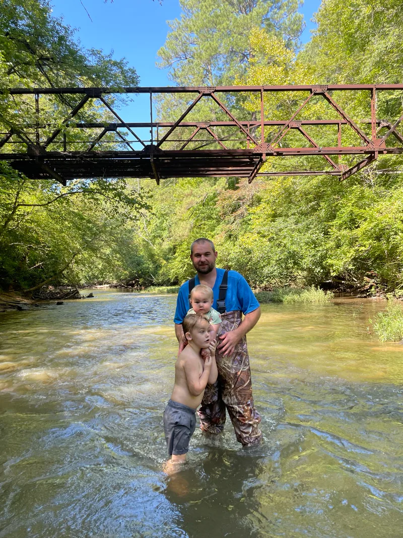
Now the survey photograph and our family photograph belong to the same history. One records the bridge for a proposed lake. The other records a father and his boys in the river beneath it.
Continue with The Lake Haralson County Never Got, the wider story of the changing water-supply plans.
Sources and photograph notes
- Thomas H. Gresham, Cultural Resources Survey of the Proposed West Georgia Regional Reservoir, 1990, report 1804: Table 10, printed p. 56 / PDF p. 74; Appendix D, PDF p. 146. Original uploaded pages inspected. The table, photograph and position support the bridge identification, confirmed by Daniel. Construction year and the people’s identities remain unresolved. UGA catalogue.
- Same report, management summary, PDF pp. 3–5, and UGA’s public abstract. Dates and totals concern the 1990 study, not every later reservoir proposal. A survey-area total is not a lake-surface acreage. The fieldwork window does not date this individual photograph or establish its relationship to the March 1990 flood.
- Modern images: Daniel Moss’s owner-supplied bridge and family photographs. North-bank orientation is Daniel’s identification. No exact capture date asserted. The original survey image is referenced rather than reproduced here; the AI-enhanced viewing experiment is not used as historical evidence or a public illustration.
Read another local story
 Bethlehem, Beside the TallapoosaPhotograph by Daniel Moss.
 The Lake Haralson County Never GotUSGS · 1975 aerial photograph
 The Road That Reached the RiverASCS aerial, January 26, 1972 · UGA Libraries / Digital Library of Georgia. Public domain. Thumbnail reduced from the article’s original crop. Display thumbnail resized; full image and sources in the story.
What story should we tell next?
Is there a person, place or piece of local history you’d like to see on Moss & Sons? Perhaps your family has photographs, letters, an old business record—or a memory you’d like to share.
You don’t need to have the whole story. Tell us what you know, and we can start there. Daniel reviews contributions and confirms permission before anything is published.
Know someone who would enjoy this? Pass it along.