RAILROADS · TOWNS · EVERYDAY LIFE
The tracks that built West Georgia
Start with a town you know. Open its “then and now” entry below, or enlarge an old map and look for a familiar name.
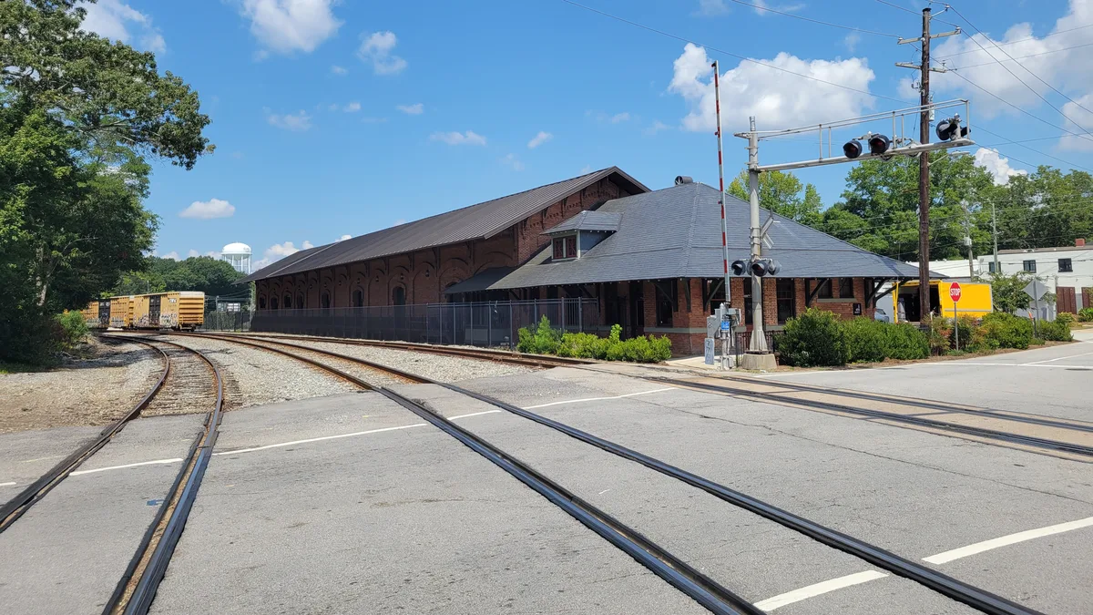

Look beyond the locomotive
A station belonged to more than the people boarding a train. Tracks connected workshops, warehouses and farms with customers elsewhere. A junction could draw business toward one part of town; a new line could make another place more useful. Georgia’s statewide railroad history describes those connections between railways, settlement and industry. [1]
In Villa Rica and Bremen, the question becomes surprisingly local: which town center, which depot, and which year? The story of the towns reshaped by the railroad follows incorporation records and historic-district evidence. It avoids turning a shift in a town’s center into a claim that every building moved.
Carrollton offers another way into the subject. A newspaper advertised connections to Atlanta through both Bremen and Newnan. An official railway complaint records neighbors asking for more passenger trains between Bremen and Cedartown. Those ordinary decisions—where to change trains, whether the service was enough—are the heart of our passenger story.
Then and now: choose a place
Open a town or landmark to compare its railway past with what you can visit today.
BremenDepot ParkPark stop
Replica shelter · public park
Then. Two intersecting railroads made Bremen a junction. The town’s earlier depot landscape and later crossing were different places; the story follows that change through local records.
Now. The park’s shelter is modeled after an old depot. It is not a surviving nineteenth-century station. Watch from designated public areas; passing trains have no visitor timetable.
121 Atlantic Avenue, Bremen, GA
Sources: Explore Georgia · park and map point · City of Bremen · history
CarrolltonDepot on BradleyInterior visit · Arrange ahead
Historic depot · arranged interior visits
Then. Carrollton’s railways connected passenger journeys with a working landscape of freight, cotton warehouses and mills. The 1900 Sanborn map below preserves that industrial setting.
Now. The restored depot is an event venue at 455 Bradley Street. The city offers arranged tours; confirm access before making an interior visit. The city’s 315 Bradley Street footer address is City Hall.
455 Bradley Street, Carrollton, GA
Sources: City of Carrollton · depot and tours · City notice · 455 Bradley Street · West Georgia Track Club · venue map point
Villa RicaDowntown and The MILLDowntown stop · Check venue access
Downtown orientation · old depot removed
Then. The railroad reshaped Villa Rica in the early 1880s. Its National Register record describes the new town plan and the depot’s later demolition, after 1950.
Now. Use The MILL at 106 Temple Street as a downtown orientation point. The pin marks the historical marker beside its ticket office, documented in 2015; it is not a parking pin or the old depot’s exact footprint. Check the venue’s current events and access before visiting.
The MILL, 106 Temple Street, Villa Rica, GA
Sources: Villa Rica visitor bureau · The MILL · National Register · historic district, pp. 3–9 · Historical Marker Database · photographed marker location
TallapoosaWest Georgia MuseumIndoor museum · Check hours
Local-history museum · check admission and hours
Then. Rail connections helped Tallapoosa attract visitors and promote hotels during its nineteenth-century boom. Surviving advertisements and family records reveal more than the promises alone.
Now. The museum at 185 Mann Street is a place to explore local life. It is not a depot; this guide does not promise a dedicated railway exhibit. Check the city’s current admission and opening information.
West Georgia Museum, 185 Mann Street, Tallapoosa, GA
Sources: City of Tallapoosa · museum · Haralson County · railroad and tourism history · Explore Georgia · destination map point
RockmartRockmart History MuseumIndoor museum · Check hours
Museum in former City Hall · not a depot
Then. Rockmart’s museum connects the town’s story with railroads, slate and Welsh workers. A railway history can begin with the material people quarried and the work they brought with them.
Now. The museum occupies the 1921 City Hall at 133 South Marble Street. Read its visit information before traveling; the building should not be mistaken for a former railroad station.
Rockmart History Museum, 133 South Marble Street, Rockmart, GA
Sources: Rockmart History Museum · building and collections · Explore Georgia · destination map point
CedartownWelcome Center depotDepot replica · Check hours
2004 replica · original depot site
Then. The welcome center recalls Cedartown’s Seaboard depot. A familiar station shape can preserve a town’s railway identity even when the structure itself is new.
Now. This is a replica built in 2004 on the original depot site, at 609 South Main Street beside the Silver Comet Trail. Check current welcome-center hours before planning an indoor visit.
609 South Main Street, Cedartown, GA
Paulding CountyPumpkinvine TrestleTrail walk · Under 2 miles return
Public trail · approach from Rambo Trailhead
Then. The trestle makes the old railroad’s crossing of the landscape visible from today’s Silver Comet Trail. It is a different kind of surviving rail landmark from a station building.
Now. The map pin is Rambo Trailhead parking, not the bridge. The trail guide places the trestle less than a mile west along the trail. Check trail notices, daylight and the return distance before setting out.
Rambo Trailhead, Silver Comet Trail, Dallas, GA
Sources: Silver Comet guide · trestle approach · Trailhead parking coordinates
Near BraswellBrushy Mountain TunnelLonger walk · About 5.2 miles return
Public trail · not a drive-up tunnel
Then. The tunnel carries the Silver Comet Trail through a former railway passage. The specialist trail guide describes an approximately 800-foot tunnel through Brushy Mountain.
Now. The map pin is Coot’s Lake Trailhead parking. The guide places the tunnel about 2.6 miles east along the trail—roughly 5.2 miles out and back. This is a longer outing; check current conditions and allow daylight for the return.
Coot's Lake Trailhead, Silver Comet Trail, Rockmart, GA
Sources: Silver Comet guide · tunnel approach · Trailhead parking coordinates
Visitor sources checked October 26, 2026. Check current hours, appointments and trail notices before leaving. Use public paths and designated viewing areas; active tracks are not walking routes.
Two maps, two ways of seeing
Start with these close-ups, then open either complete map to see its wider setting. Tap a detail to enlarge it.
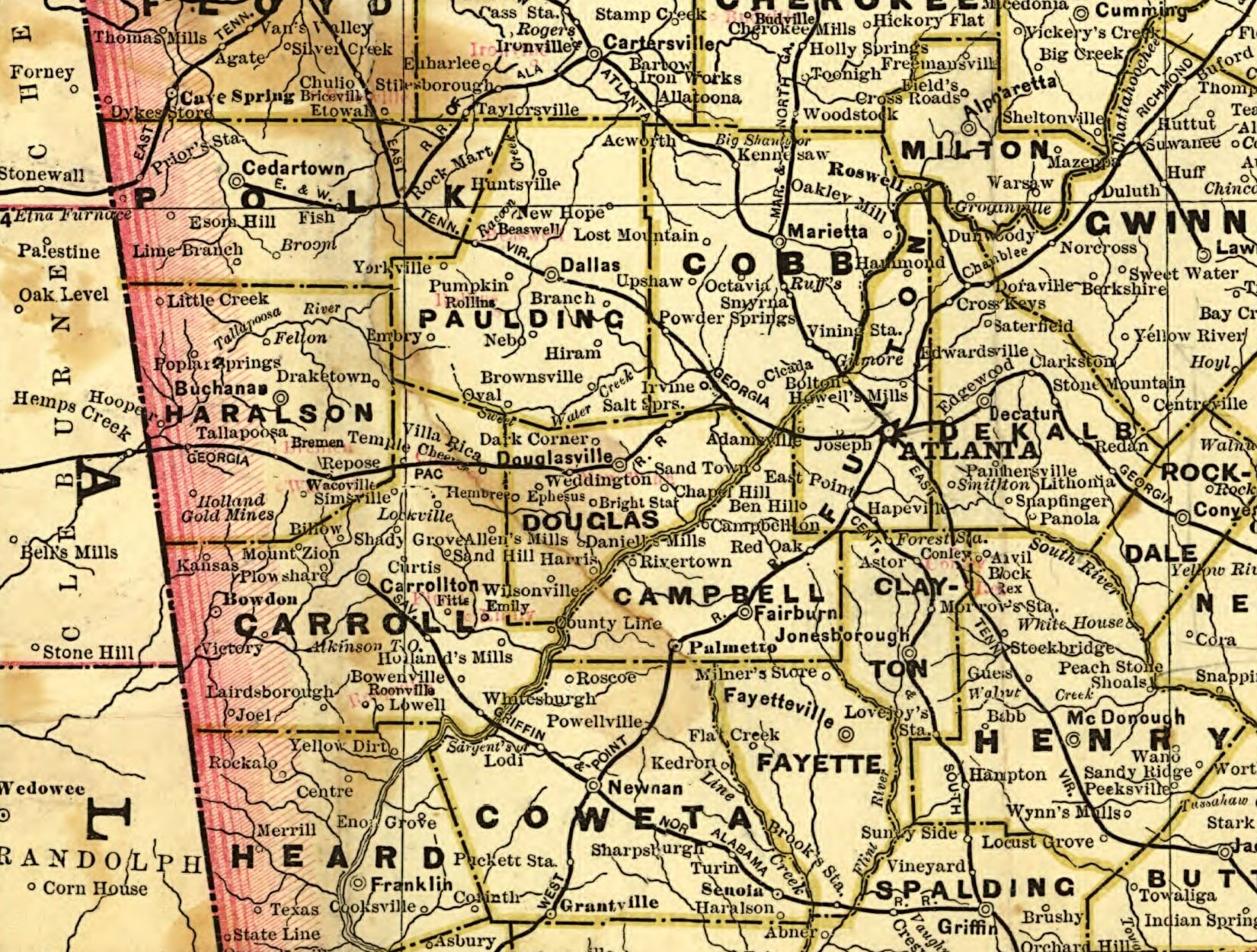

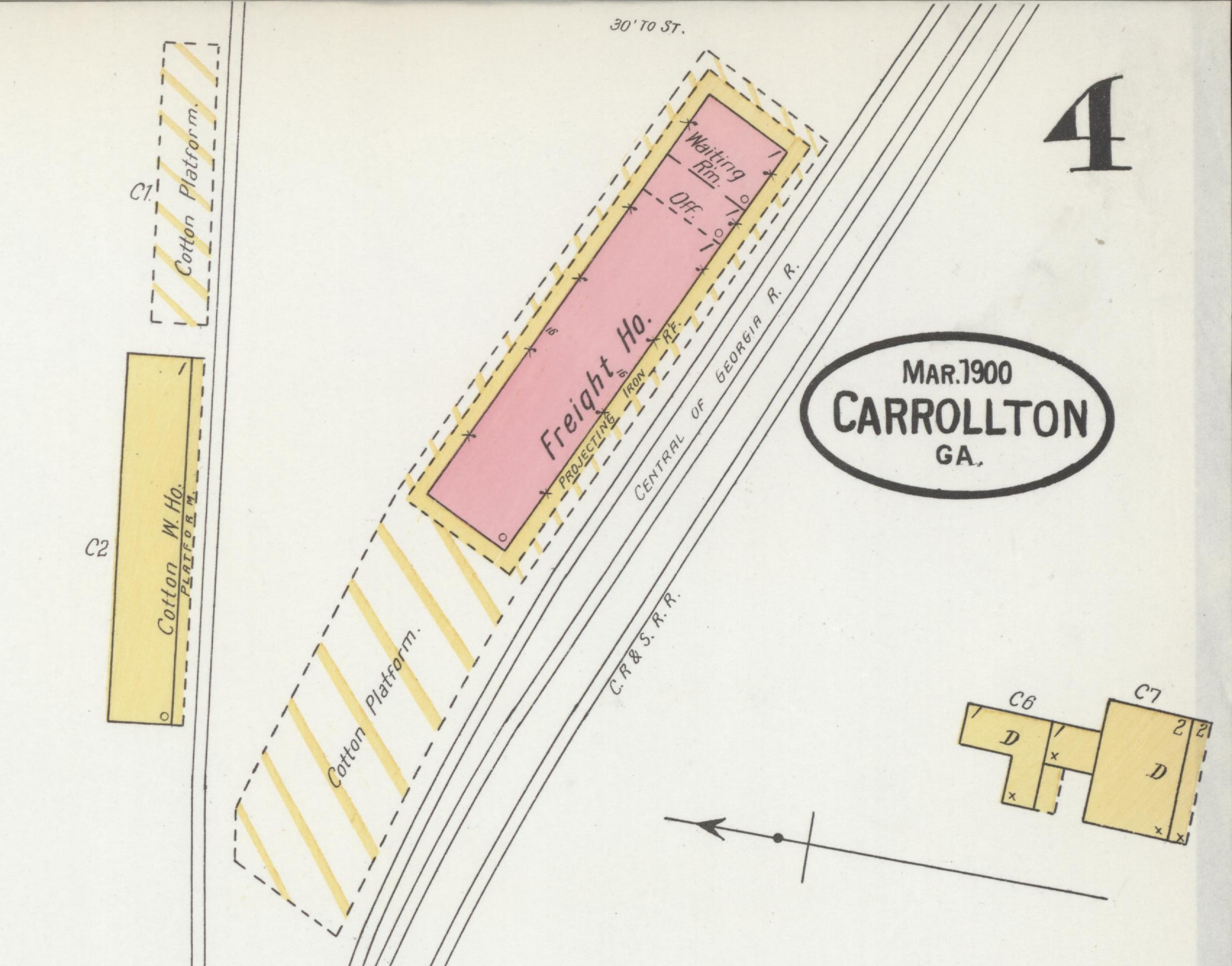
A freight map does not tell us who worked every shift, what they earned, or how much passed through a warehouse. It does show what stood beside the rails at the time of the survey. That is a useful beginning for asking better questions.
Follow the people and the places
Changing trains at Bremen
A Carrollton–Atlanta connection, the workers building the line, and passengers who pressed for better service. Original newspaper and commission records also reveal the limits and racial divisions of railway travel.
When the railroad moved the town
Follow Villa Rica and Bremen through town charters, railway geography and the distinction between an old settlement and a new center.
The Bremen hiding in plain sight
Depots, a crossing, merchants and manufacturing behind familiar streets.
Tallapoosa’s boomtown promises and vineyard families
Rail connections meet advertising, ambition and the lives families built here. Continue with the many lives of the grand hotel.
Sources and further reading
- Alexandra C. de Kok, The Statewide Railroad Industry Context (1991). Georgia Rails Into Trails Society, Trust for Public Land and Georgia DNR Historic Preservation Section. Historical context; its 1991 plans and forecasts are not current visitor guidance.
- Cram’s 1883 Georgia railroad map and Carrollton’s March 1900 Sanborn maps. Captions identify each record and its reuse rights.
Research and map notes
Each place entry links its own historical or visitor sources. Trail distances come from the Silver Comet specialist guide linked by Paulding County; they are planning estimates, not a field survey. The eight map pins use published destination, historical-marker or trailhead coordinates. The MILL’s marker point comes from a 2015 photographed record; other venue points also do not certify a particular entrance or parking space. No historic track alignment has been reconstructed on the modern map. The two archival details are crops of the original scans; no labels or lines have been redrawn. Each complete map remains available beside its detail.
This is an introduction to several connected local histories, not a complete inventory of every railroad or depot. Original records and family contributions can deepen it. Photographs and memories submitted below remain subject to review and permission checks.
Read another local story
 Changing trains at BremenSanborn, 1900 · Library of Congress · public domain
- Bremen hiding in plain sight
- When the railroad moved the town
Share a photo, memory or landmark
Daniel reviews contributions before anything appears publicly.
Know someone who would enjoy this? Pass it along.