CARROLL COUNTY · SCHOOLS & COMMUNITY LIFE
A school map from 1918. A different view of home.
A lodge over a classroom. A church used as a school. A blank where a school year should be. Eight original records reveal how local education occupied the landscape.
In 1918, state rural school agent M. L. Duggan surveyed Carroll County’s schools and urged consolidation. His report combined a district map, photographs, building descriptions and financial figures. It records the county board’s adoption of the district map on May 8, 1918. The document lets us connect familiar names with particular buildings and conditions, while keeping the surveyor’s judgments separate from a complete community history. [1]
EXPLORE THE RECORD
Find a school. Compare the evidence.
Eight selected entries, not a complete county inventory. All figures below come from the 1918 report; missing values stay missing.
8 of 8 selected entries shown
DISTRICT 12 · PRINTED PAGE 34
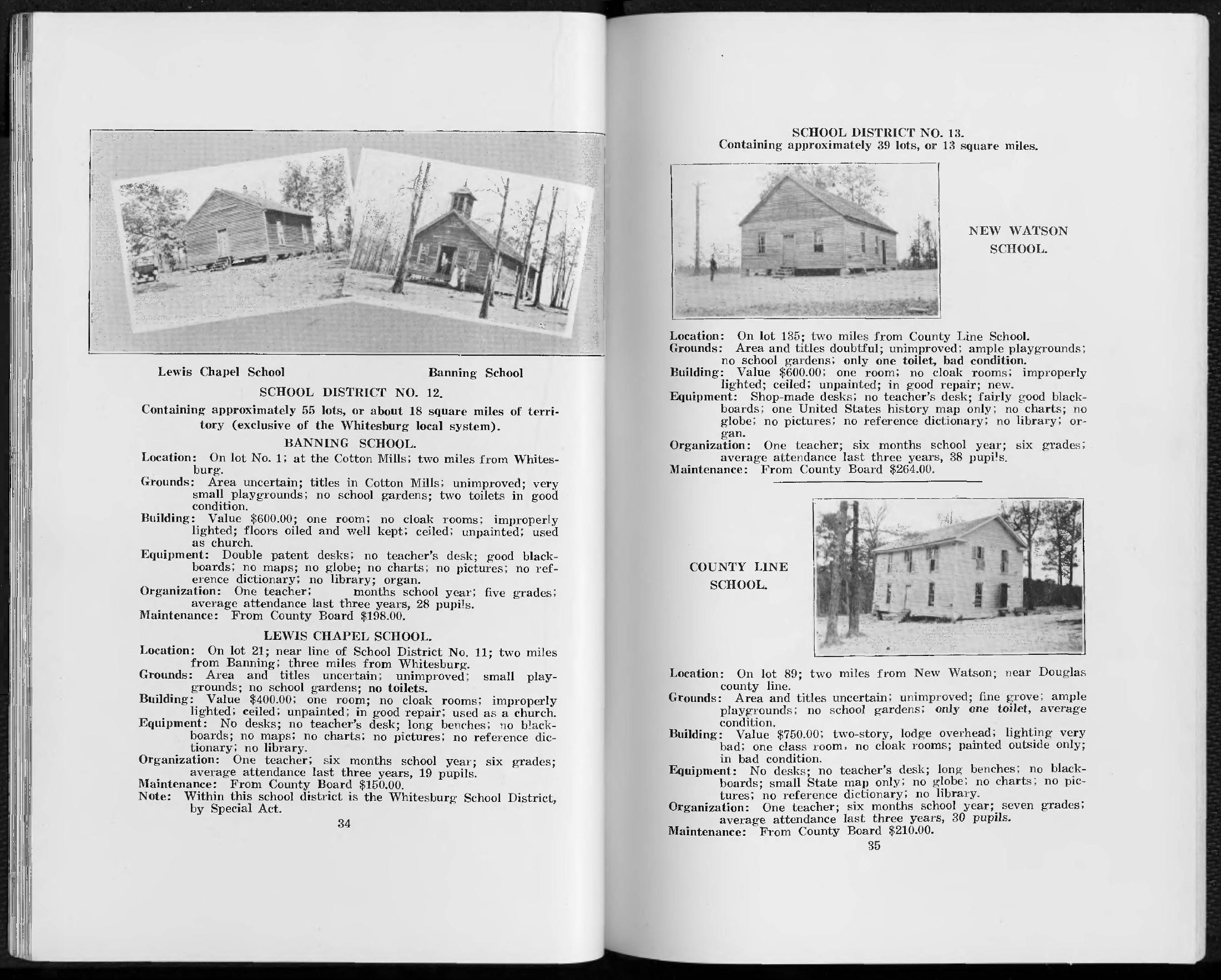
Banning
Lot 1, at the cotton mills; two miles from Whitesburg.
The report places the land title with the cotton mills and describes the one-room building as also used for church. No library was recorded.
Limit: The school-year length is blank in the original; no closure date or modern parcel has been established.
DISTRICT 12 · PRINTED PAGE 34
Lewis Chapel
Lot 21, near district 11; two miles from Banning and three from Whitesburg.
The report describes a one-room building also used as a church, long benches rather than desks, and no library.
Limit: The report calls the land area and title uncertain. It does not identify present ownership.
DISTRICT 14 · PRINTED PAGE 36
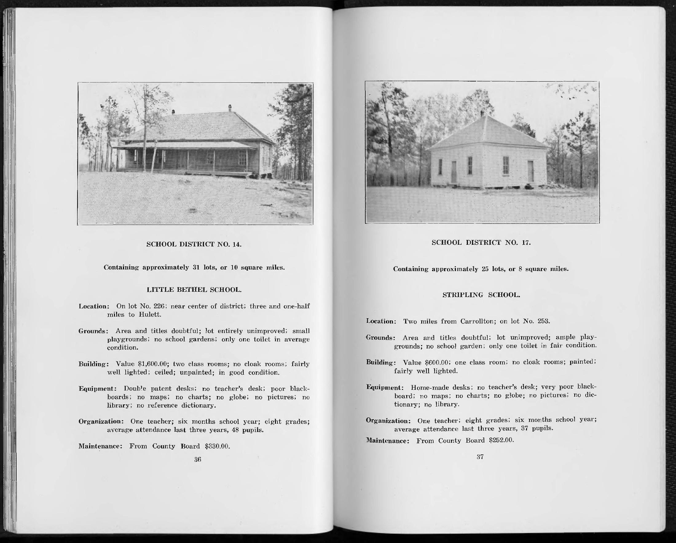
Little Bethel
Lot 226, near the district center; three and a half miles from Hulett.
Two classrooms and one teacher are recorded. The report calls the building’s condition good, but records no library or reference dictionary.
Limit: Two classrooms do not establish that two teachers worked there in 1918.
DISTRICT 18 · PRINTED PAGE 42
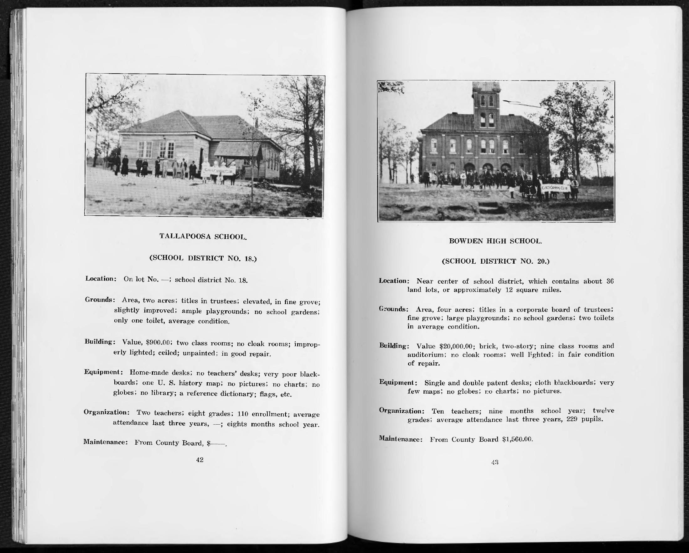
Tallapoosa (Carroll County)
School district 18; the land-lot number is blank in the original.
The report gives 110 enrollment and two classrooms, with homemade desks and a reference dictionary. It leaves average attendance blank.
Limit: This is the Carroll County school in the survey, not an identification of a school in the city of Tallapoosa, Haralson County.
DISTRICT 32 · PRINTED PAGE 59
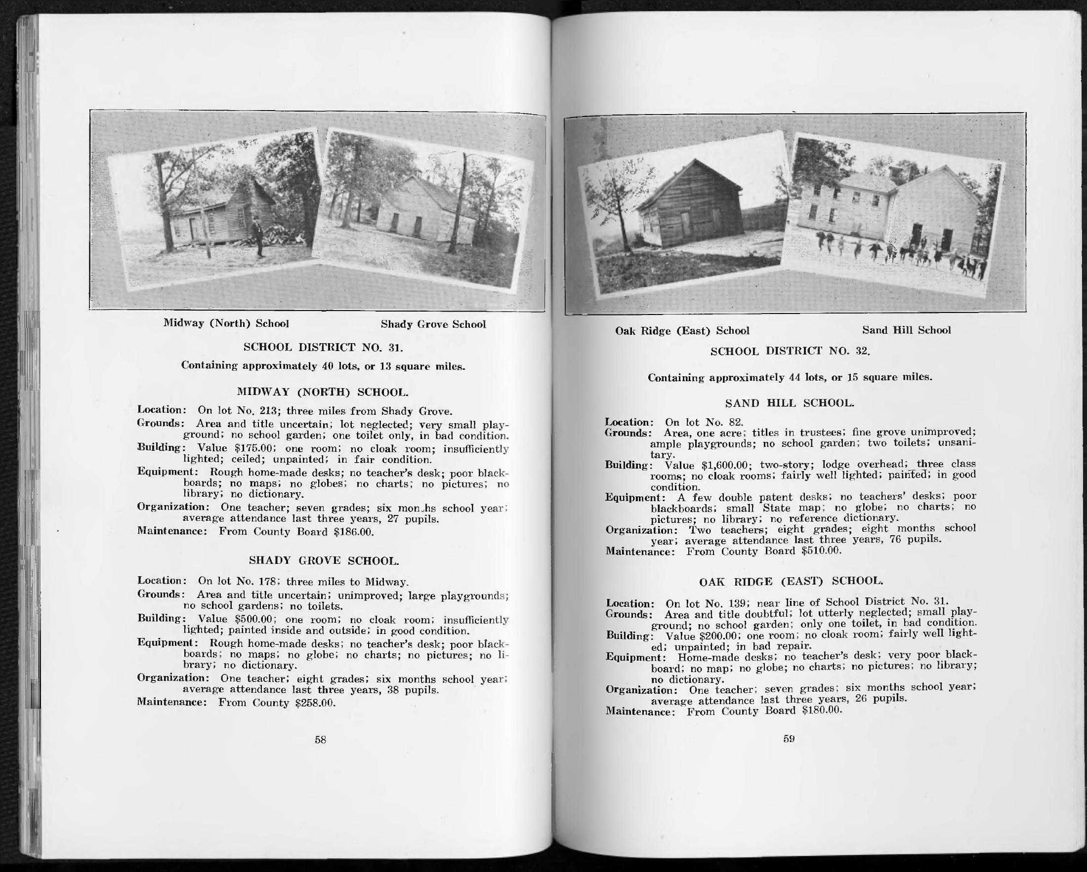
Sand Hill
Lot 82; one acre, with title described as held by trustees.
A two-story building with three classrooms and a lodge overhead. The report describes a painted building in good condition but no school library.
Limit: The lodge is not named here. This 1918 building must not be assumed to be the later laboratory-school building.
DISTRICT 32 · PRINTED PAGE 59
Oak Ridge (East)
Lot 139, near the boundary of school district 31.
One room, homemade desks and no library. The survey describes the building as unpainted and in bad repair.
Limit: Keep the East qualifier: similar school names elsewhere are not interchangeable.
DISTRICT 1 · PRINTED PAGE 17
Rotherwood
Land lot 84; three miles from Whitesburg, Lewis Chapel and Shiloh, as reported.
A small single room adjoining a church lot, rough homemade desks, and no library or blackboard are reported.
Limit: Historical road distances are not present driving directions; land title was described as doubtful.
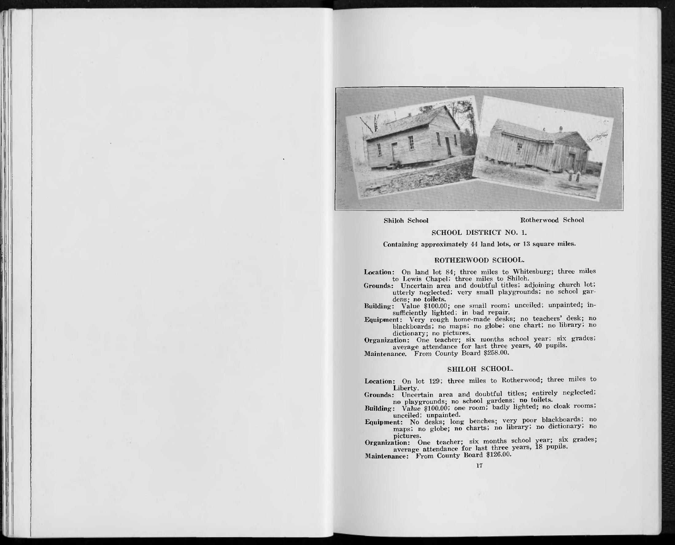
DISTRICT 1 · PRINTED PAGE 17
Shiloh
Lot 129; three miles from Rotherwood and Liberty, as reported.
One room with long benches and no desks or library. The report describes the building as unpainted.
Limit: The name alone does not match this school to a modern church, road or surviving structure.
Side-by-side comparison
| Measure | Banning | Sand Hill |
|---|---|---|
| Teachers | 1 | 2 |
| Grades | 5 | 8 |
| School year, months | Not recorded | 8 |
| Average attendance, preceding 3 years | 28 | 76 |
| Enrollment | Not recorded | Not recorded |
| Estimated building value, 1918 dollars | $600 | $1600 |
| County Board maintenance, reported dollars | $198 | $510 |
Attendance is the report’s average for the preceding three years, not enrollment. Building values are historical estimates; maintenance is the County Board contribution recorded here, not a verified total school budget. First school’s source page · Second school’s source page.
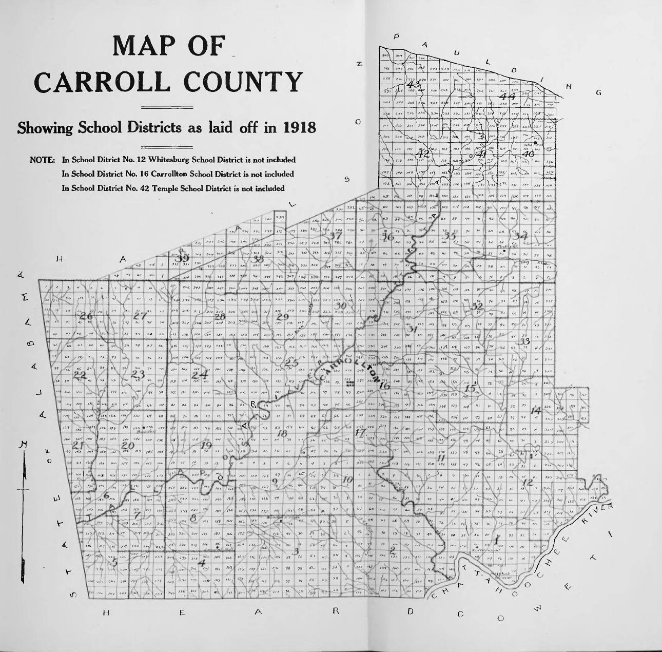
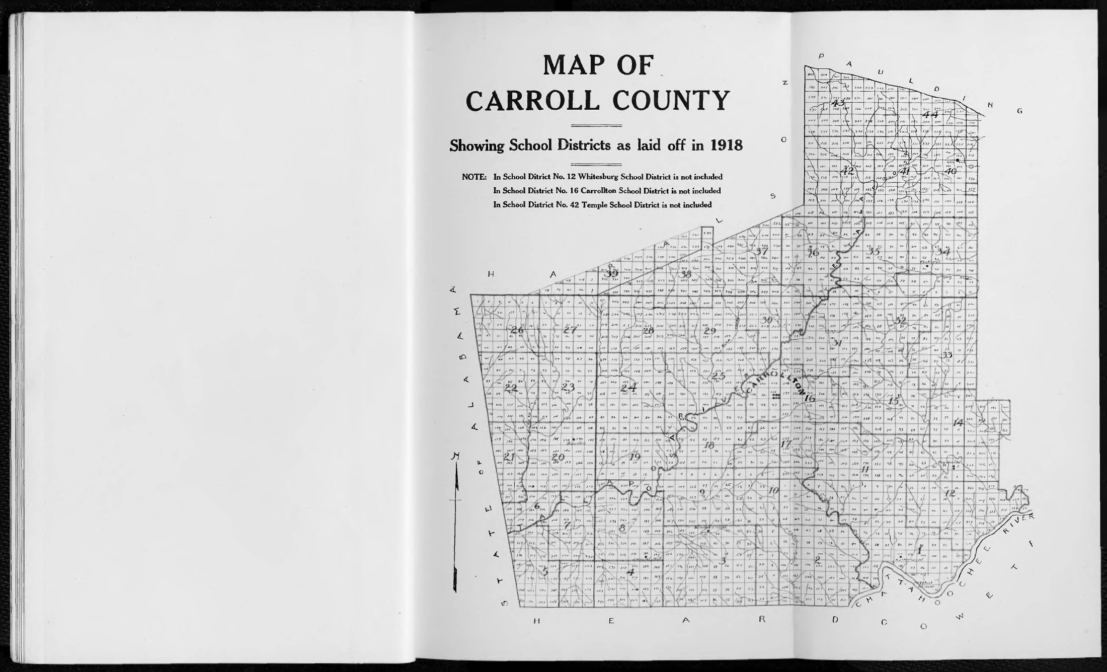
The district map adopted in 1918
The large numbers identify school districts; smaller numbers identify land lots. The map separately excludes the Whitesburg, Carrollton and Temple local systems from the surrounding numbered districts. These are not today’s attendance zones.
Small details that change the story
Sand Hill had a lodge overhead. The report describes three classrooms in a two-story building. It does not identify the organization occupying the upper floor. Lodge minutes, deeds and local newspapers would be needed to attach a name to that shared use. [1, p. 59]
Banning’s school was tied to the mill property. Its entry places title with the cotton mills and describes the room as also serving as a church. That connects the industrial landscape to daily community life without telling us what the children’s families earned or how they understood their schooling. Our Banning mill explorer follows that wider setting. [1, p. 34]
A blank is evidence of a gap. Tallapoosa’s entry supplies enrollment of 110 but leaves average attendance blank. Banning’s school-year length is also blank. Filling those spaces from a neighboring entry would manufacture data. The comparison and CSV preserve them as missing. [1, pp. 34, 42]
What happened next?
UWG’s later laboratory-school collection identifies Sand Hill among the schools involved in West Georgia College’s rural teacher-training program. The collection includes surveys, correspondence, photographs and student-teacher observations. That offers a route into later change, but the shared school name alone does not prove the 1918 building was the one used in subsequent decades. [2]
To follow any one school faithfully, we would match school-board minutes, land transfers, teacher appointments and dated photographs. A district on the 1918 map is not a current parcel. A surviving place name is not proof that the original schoolhouse survives.
Black school histories need their own records and voices, including school-board accounts, teachers’ records, church and family collections, and relevant oral histories. They should not be inferred from the omissions of this white-school consolidation survey.
Sources and method
- Georgia Department of Education, M. L. Duggan, Educational Survey of Carroll County, Georgia, No. 25, 1918. Preliminary report, district map and printed pp. 17, 34, 36, 42 and 59. Scanned map and all eight transcribed entries visually checked. Complete digitized report. Original 1918 publication is public domain; digital source: UGA Map and Government Information Library / Digital Library of Georgia.
- University of West Georgia, Teacher Training Program and Laboratory Schools collection, UA-0005-47. Finding aid inspected; individual later school files not retrieved or reproduced.