OLD NAMES · ROADS · FAMILY RECORDS
Before the familiar towns: Haralson’s forgotten post offices.
Burnt Stand. Newsville. Repose. Etna. These names belong to the county’s documented postal past. Finding where their mail was handled is the first step toward understanding the communities around them.
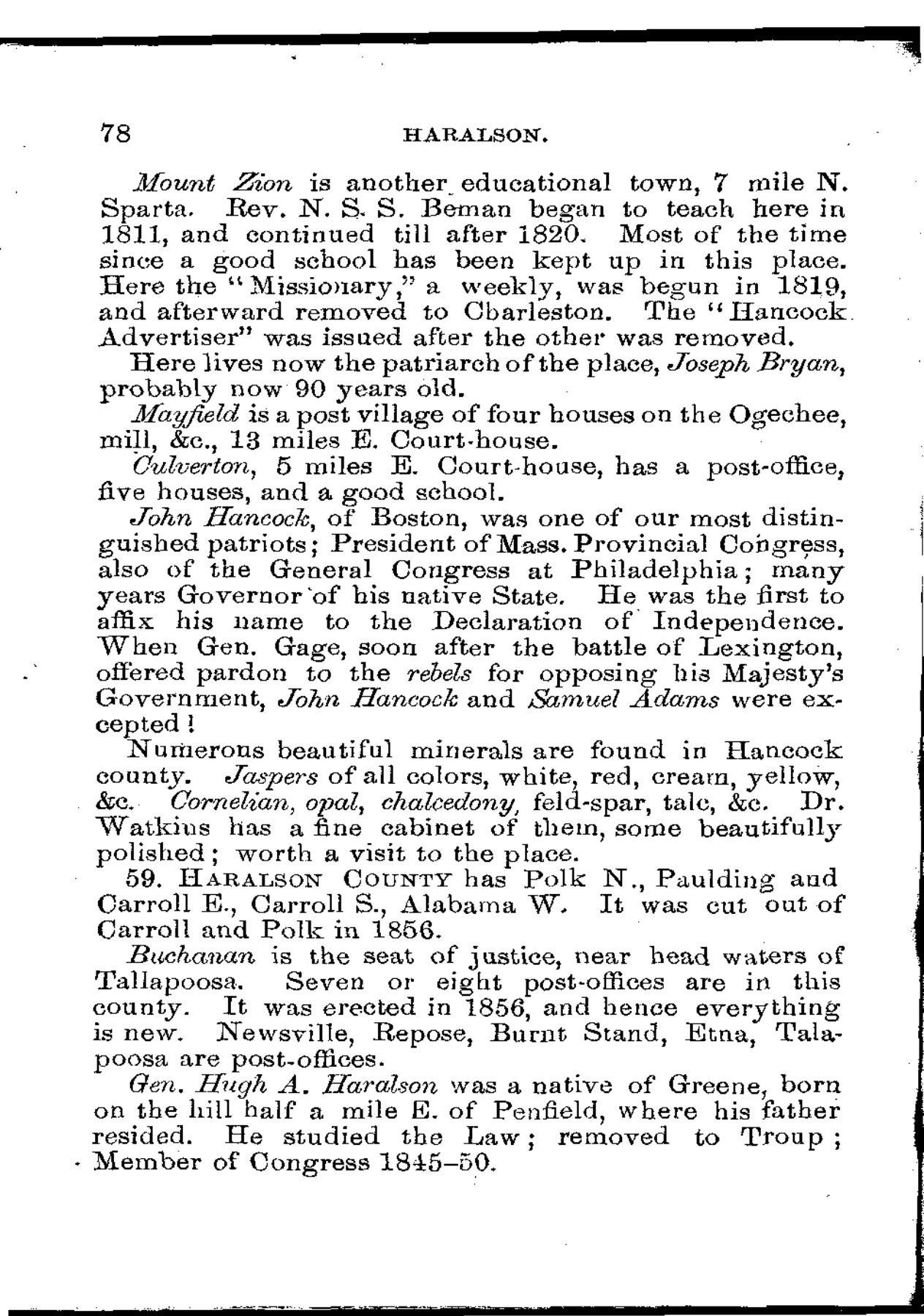
On page 78 of his 1860 Gazetteer of Georgia, Adiel Sherwood described Haralson County, its boundaries and Buchanan’s position near the headwaters of the Tallapoosa. Then he recorded a different geography: the places where people received their mail. His list includes Newsville, Repose, Burnt Stand, Etna and “Talapoosa.” We checked those names against the scanned page, rather than relying only on its machine transcription. [1]
That is a firm starting point. It does not establish five abandoned towns. A post-office name could refer to a crossroads, neighborhood or a postmaster’s place of business. An office might move or change its name while the surrounding families remained. The National Archives explains this distinction in its guide to postal records. [2]
What the directory actually establishes
Sherwood says the county had “Seven or eight post-offices,” then names five after describing Buchanan. That approximate total and selective list are evidence of the directory’s limits. They are not a complete count of settlements, a population table or proof that every office occupied a purpose-built building. [1]
| Name | Evidence available | What remains to find |
|---|---|---|
| Burnt Stand | Named in the 1860 Haralson entry. An indexed 1851 newspaper transcription also places it on a proposed mail route between Buckhorn and Tallapoosa. | The original newspaper image, postmaster appointments and a site report; no modern parcel established. |
| Newsville | Named as a post office in the 1860 directory. | Appointment and site-location records, followed by deeds connecting the postmaster to a property. |
| Repose | Named in 1860. Kenneth Krakow’s later place-name reference connects Repose with the settlement at present-day Bremen. | The original postal name-change or discontinuance record and a dated location description. |
| Etna | Named in the Haralson entry in 1860. | Records that distinguish this office from similarly named places elsewhere; no verified modern pin. |
| Talapoosa | This is the directory’s spelling of the familiar name. | A dated sequence of office sites; the name alone does not locate the 1860 building. |
Burnt Stand and the road toward Alabama
A postal-contract advertisement in the March 6, 1851 Savannah Daily Republican offers a promising earlier lead. Its indexed transcription names Villa Rica, Buckhorn, Burnt Stand and Tallapoosa along a route continuing through Oak Level and Rabbit Town to Jacksonville, Alabama. That sequence places Burnt Stand within a regional connection, rather than leaving it as an isolated name in a county list. [3]
This remains a transcription-level finding. We could read the indexed newspaper text, but the archive’s image access was blocked during this review. The original scan needs checking. A route advertisement also describes proposed service; it does not establish that a contract was awarded or that a carrier completed every trip.
The Haralson County Historical Society’s later account identifies the Middle Alabama Road with the Tallapoosa or Sandtown Road and describes it passing through Burnt Stand toward Tallapoosa. This is a useful research lead, not a surveyed match to present roads. Connecting it to a modern road requires dated maps, road orders and property descriptions. [5]
We have therefore left the route as an ordered list of names. A precise-looking map would imply coordinates and a continuous road alignment that this research has not established.
Was Repose an earlier Bremen?
Kenneth Krakow’s Georgia Place-Names identifies Repose as the original settlement on Little River at the site of present-day Bremen. That makes Repose a particularly useful lead for families researching Bremen before its familiar name. It is a later reference work, however, not the original postal order or a deed locating the office. [4]
The careful statement is that an 1860 primary source names Repose in Haralson and a later place-name reference connects it to Bremen. We have not established the precise office site, a formal renaming date, or whether the postal location shifted. Those are separate questions.
Our Bremen history study follows the later town. Reading the two together may eventually reveal whether older routes and property lines survived beneath the railroad-era layout. That continuity is a question to test, not a conclusion reached here.
How to put a lost name back on the map
The next search has two exact federal record targets: M841, postmaster appointments for 1832–1971, and M1126, post-office site-location records for 1837–1950, both within National Archives Record Group 28. The former can establish an office’s administrative sequence; the latter may describe nearby streams, roads, stations and other offices. Early site reports can be sparse. These specific Haralson office files have not yet been retrieved. [2]
- Find each office’s appointments, establishment, discontinuance and name changes. Search the relevant earlier county as well as Haralson: Sherwood records the county’s formation from Carroll and Polk in 1856. [1]
- Match a dated site report to the postmaster’s land deeds and tax records. A surname match alone is insufficient.
- Compare those property descriptions with contemporary maps and county road records. Record changes of site separately.
- Only then publish a modern location, with its evidence and uncertainty. A roadside marker, surviving foundation or family recollection can help, but each needs a documented connection.
For now, none of the uncertain offices in this article has a verified ruin, public visiting address or historical driving route. Names recurring elsewhere in Georgia must be separated by county and date. A postal closure would establish an administrative change; explaining a community’s decline would also require households, employment and property evidence.
Sources and research limits
- Adiel Sherwood, A Gazetteer of Georgia, fourth edition, 1860, printed page 78. Original scanned page inspected. Full digitized volume.
- National Archives, Post Office Records. Research guide to RG28, M841 and M1126. Guide inspected; individual local files remain outstanding.
- Savannah Daily Republican, March 6, 1851, image 4, indexed route 3389 advertisement. Search-index transcription inspected; original newspaper image not verified.
- Kenneth K. Krakow, Georgia Place-Names, R entries, Repose. Secondary place-name identification; not a postal order or parcel survey.
- Haralson County Historical Society, early county history. Later road and postal narrative. Its repetition of the directory names is not counted as independent primary confirmation.