TALLAPOOSA RIVER · WEST GEORGIA
Dub Denman map & float planner
Choose where to start and finish. See the rough float time, check conditions, and ask for help with the parts you still need to arrange.
Choose your float
Poplar Springs to Highway 100
About 2–3 hoursApprox. 5.3 river milesPast-trip planning times. Allow extra for your conditions, loading and the return journey.Loading the detailed map…
The highlighted line follows public river-centerline data. Amber is upstream of Access 1; green is the public Dub Denman section from Poplar Springs. It is a planning trace, not a verified safe channel or a statement that access is open.
Check before launching: the Chamber reported a Highway 100 bridge obstruction and river-left portage in the source review on September 7. Verify the current approach, landing, permission, and condition. Read the Chamber notes.
Map key, mileage & controls
Poplar Springs · Access 1 · Mile 0Amber · Upstream stretch & private HipcampGreen · Public Dub Denman sectionUP = miles upstream of Poplar Springs. Numbered miles count downstream. Our planning scale—not official mile signs.
Source-linked public accessAddress conflictReported—not verified publicPrivate location-hidden zone—not a boundaryClickable two-mile referenceGreen · Dub Denman from Access 1Amber · upstream; dashed selection is context only
River mile markers are off initially. Enable them in LAYERS when needed. Tap a pin for its name and Maps link. Use +/− to zoom or LAYERS for street and terrain. On a phone, use the control below the map to enable dragging and pinching; lock it to scroll the page again. “Fit selected trip” returns to your chosen route after exploring.
All access points & coordinate links
- RUS Highway 27 bridgeApprox. 9.5 mi upstream of Access 1 · BRIDGE REFERENCE · 33.863380, -85.213290 · reported use—not verified public accessVIEW CROSSING
- HThe developed Tallapoosa HideawayPrivate · upstream of Access 1 · exact location hidden · symbol is not a boundary · the separate Wilderness Retreat is not plottedHIPCAMP
- 01Poplar SpringsAccess 1 · Mile 0 · 33.813580, -85.275970 · source-linked public accessVIEW AREA
- 02GA Highway 100 / Water WorksAccess 2 · Approx. mile 5.3 · 33.776260, -85.296401 · source-linked public accessVIEW AREA
- 03Broad StreetAccess 3 · Approx. mile 9.9 · MAPPED LAUNCH PIN · 33.766182, -85.322488 · published address conflict—verify firstSEARCH + VERIFY
OPEN THE TWO-MILE RIVER COORDINATES
Mile 0 is Poplar Springs. UP labels count miles upstream; green labels count downstream. Each is an approximate centerline reference—not access or navigation advice.
- 8 mi UP
33.863053, -85.234018VIEW COORDINATE - 6 mi UP
33.852241, -85.246906VIEW COORDINATE - 4 mi UP
33.840561, -85.259487VIEW COORDINATE - 2 mi UP
33.826137, -85.273543VIEW COORDINATE - 2 mi
33.789718, -85.267771VIEW COORDINATE - 4 mi
33.787227, -85.288141VIEW COORDINATE - 6 mi
33.775970, -85.303779VIEW COORDINATE - 8 mi
33.764781, -85.309125VIEW COORDINATE
Map sources & distance notes
- US 27 crossing
- Approx. 9.5 mi upstream of Access 1
- Poplar Springs
- Access 1 · Mile 0
- Highway 100
- Access 2 · Approx. mile 5.3
- Broad Street
- Access 3 · Approx. mile 9.9
A mapped river reference—not turn-by-turn navigation. The amber upstream line uses USGS NHDPlus HR data; the green public section uses Georgia River Network data. Our mileage starts at Poplar Springs, Access 1—not Highway 27. The same measured reaches total approximately 19.45 miles from US 27 to Broad Street. Two-mile references are proportionally placed along each measured reach; they are not official mile signs. Neither line identifies a safe channel, obstruction, portage, shoreline right, or usable access today. US Highway 27 is reported use only, Broad Street keeps its published-address warning, and the private Hipcamp symbol is a broad location-hidden zone—not a property boundary.
MAP BY MOSS & SONSmossandsonsga.com/guides/dub-denman-canoe-trail
ASK MOSS & SONS
Only one vehicle?
Short a kayak?
Planning a family or group float? Ask Daniel about a pickup, an extra kayak, or another missing piece. We may be able to help work out a practical plan.
Route to discussPoplar Springs to Highway 100Not sure about the route? Say so in your message.
Add your date & group details Optional
This opens a draft for you to review and send. Any help, equipment, timing, meeting place, and cost must be agreed with Daniel before you make plans around it.
Have two vehicles? Plan your own shuttleCompare all float timesEvery downstream combination, with the basis for each estimate.
Want to make a night of it? Our private riverside campsite near Buchanan gives one registered group a place to settle in. Check dates on Hipcamp and ask about firewood for your stay if you are planning a permitted evening fire. The stay is booked separately from your paddle and return plan.
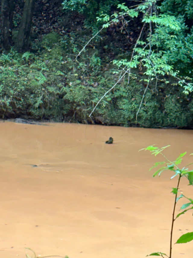
Dated September 12, 2026 in the photo collection. This photograph is separate from the Highway 27 trip report; it does not show current conditions.
Check the current river sourcesLaunch details & directionsPublic access, private permission, and locations that need checking.
SOURCE-LISTED PUBLIC LAUNCHES
Know the order.
Verify the ground.
These are public-source planning details, not a same-day opening report. Confirm access, parking, hours, posted rules, landing condition, shuttle logistics, and the actual takeout before leaving home.
01UPSTREAM ACCESS NAME
Poplar Springs
2122 Poplar Springs Road, Tallapoosa, GA 30176Current state and local tourism sources agree on this listed address. Present signs, gate, parking, bank condition, and lawful launch area still require a current operator or field check.
33.813580, -85.275970View launch area in Google MapsMapped launch-area pin aligns with Georgia River Network trail geometry. It opens an area search—not turn-by-turn driving directions. Confirm the lawful entrance, signs, and parking before travel.02MIDDLE ACCESS NAME
GA Highway 100 / Water Works
4689 GA Highway 100, Tallapoosa, GA 30176Current state and local tourism sources agree on this listed address. The present entrance, gate, parking, landing condition, and any obstruction or portage instructions still require a current operator or field check.
33.776260, -85.296401View launch area in Google MapsMapped launch-area pin aligns with the Georgia River Network trail line and mapped slipway. It opens an area search—not turn-by-turn driving directions. Verify the lawful entrance, gate, parking, and landing.03DOWNSTREAM ACCESS NAME
Broad Street
ADDRESS CONFLICT — VERIFY WITH THE CURRENT LOCAL SOURCEThe current Chamber page and its linked brochure list 1985 Broad Street; Explore Georgia lists 1085. This guide does not choose between them until the managing authority or field review resolves the conflict.
MAPPED LAUNCH PIN · 33.766182, -85.322488Search and verify in Google MapsThe mapped Launch 3 pin aligns with Georgia River Network trail geometry and the 1085 listing. Current local sources print 1985, so use the Maps search only to inspect the area and verify signs before driving.How this guide is checkedSource dates, estimates, field-review status, and known limits.
QUICK ANSWER
Three source-listed launches.
One changing river.
Current county and tourism sources name Poplar Springs, GA Highway 100 / Water Works, and Broad Street in that upstream-to-downstream order. Published mileage, the Broad Street number, and some operational details conflict, so this page keeps source facts and field facts visibly separate.
Compare the launch notes- WHERE
- Tallapoosa River · Haralson County, Georgia
- PUBLIC LAUNCH NAMES
- Three listed by current county and tourism sources
- TRAIL LENGTH
- Often described as about 27 miles; published figures conflict
- FIELD STATUS
- Moss & Sons field review pending
- THIS GUIDE IS
- Independent planning help—not the trail operator or a live hazard report
SOURCE CHECKED · FIELD REVIEW PENDING
Useful now.
Still honest about limits.
Public launch names and public-to-public averages come from current public sources. Private-section times are labeled past-trip owner reports, and combined ranges are simple sums. The new Highway 27 report covers one trip only; its exact date and corresponding gauge reading were not supplied. Moss & Sons has not yet completed its own full route inspection, so this is not a verified navigation map, opening confirmation, or promise that a landing, obstruction, or portage is usable today.
- Content updated
- September 20, 2026
- Sources reviewed
- September 7, 2026
- Cleanup checked
- September 1, 2026
- Field review
- Full route inspection pending
- Next review due
- October 7, 2026
Check the current operator pages before travel, read every posted sign at the ground, and have another lawful takeout plan. A missing online closure notice is not proof that a launch is open.
Weather, alerts & official river sourcesOpen the current agency pages before leaving.
OPEN THESE IMMEDIATELY BEFORE LEAVING
Conditions change.
Use live pages.
Gauge trends, forecasts, and alerts are decision inputs—not a Moss & Sons safety rating. Conditions may differ away from the gauge, and the absence of a warning does not certify a trip.
RIVER MEASUREMENTUSGS gauge 02411930Provisional gauge height and discharge at US 78 near Tallapoosa. No universal safe-run threshold is claimed.OPEN LIVE DATAFLOOD CONTEXTNOAA river forecastFlood categories describe possible impacts, not paddling suitability. Check the full trend and current notices.OPEN NOAA GAUGEACTIVE WEATHER ALERTSNWS alerts near the riverPostpone for flood alerts, thunderstorms, heavy rain, rapid rises, or conditions beyond the group's ability.OPEN ACTIVE ALERTSRULES & EQUIPMENTGeorgia DNR boating deskCheck current PFD and equipment rules for the actual people and craft. Continuous PFD wear is the wiser practice.CHECK CURRENT RULES
Packing, trip cards & optional gearStart with what you already own; build a list for your group.
FREE, PRIVATE TRIP PLANNING
Build the plan
before the parking lot.
The Tallapoosa River Companion keeps the live-source desk, a trip card for someone ashore, a tailored pack list, family rules, wildlife prompts, and an off-water closeout together. It requires no account and does not request device-location permission.
Open the River CompanionFit the gear to the paddler and the trip.
Use sound equipment you already own. Check the route, river conditions, lawful access and the ride home before buying anything for a Tallapoosa River day.
Start with the life jacket.
A properly fitted, adjustable adult paddling life jacket should allow a full paddle stroke while staying securely fastened. Check the actual Coast Guard approval label, intended activity and size range. An adult vest is not a substitute for a correctly fitted child’s life jacket. Wear it on the water.
Choose a kayak you can handle ashore, too.
A 10-foot sit-on-top recreational kayak is a starting category to compare, not a promise of stability or suitability for today’s river. Check the manufacturer’s intended use, paddler-and-gear capacity, hull weight, seat fit and transport requirements. Try the fit and handling before committing where possible.
Keep the dry items together.
A 10-liter dry bag may suit small essentials; a 20-liter dry bag leaves more room for spare clothing. Check the closure and immersion rating for the actual model. Test it empty, close it as directed and secure it without loose entangling lines. It is not flotation equipment.
Bring drinking water, food, sun protection and a way to pack out your trash. Use the free river packing planner for the rest of the trip.
Gear guidance checked October 9, 2026. Coast Guard life-jacket guidance. This gear review does not change the route’s separate access or field-review status.
PACK FROM HOME · NO PRODUCT LINK NEEDED
Water, easy snacks and a small cleanup bag belong in the plan.
Fill enough sealed drinking water for every person before leaving, then carry a reasonable reserve for heat, delay, or a missed takeout. Do not plan to drink untreated river water. Pack simple food that tolerates heat and movement—whole fruit, peanut-butter crackers, trail mix, jerky, or sturdy bars—and account for allergies, medicines, children, and the actual length of the day.
- Keep water and one snack where they can be reached without opening the main dry bag.
- Move snacks into a reusable container or resealable bag when practical to reduce loose wrappers.
- Pack travel hand sanitizer and two sealable, opaque bags for used wipes and other personal trash.
- Avoid glass and food that quickly spoils or melts in heat.
- Keep hooks, sunscreen, repellent, and personal-waste items separated from food.
- Carry every wipe, wrapper, food scrap, line clipping, and piece of trash back out.
Water contact & planning with childrenSupervision, life jackets, runoff, and the family river rules.
RAIN, RUNOFF & WATER CONTACT
Clear-looking water
is not a laboratory result.
Heavy rain can wash germs and pollutants into rivers while also changing current, depth, debris, and obstruction hazards. Avoid swimming, wading, or other high-contact activity after heavy rain and whenever water is unusually cloudy, discolored, odorous, foamy, scummy, high, fast, advised, closed, or uncertain.
Never swallow untreated river water. Wash hands before eating. Moss & Sons does not sample this river, and no fixed number of hours creates an all-clear. Check current notices and use conservative judgment.
Private river days, stays & caring for the riverCompare the two retreats, guest access, and cleanup sources.
CARE FOR THE RIVER
Join the work
when a date is confirmed.
Keep Haralson Beautiful is the established local organization associated with Tallapoosa River litter pickups. No upcoming cleanup date is presented here until an organizer or official source confirms it.
ANNOUNCEMENTS LAST CHECKED · SEPTEMBER 1, 2026Bring back more than you carried in. Use lawful access. Leave the banks, water, and welcome better for the next family.
PUBLIC ACCESS AND PRIVATE HOSPITALITY STAY SEPARATE
Book the stay.
Do not assume the route.
Moss & Sons is connected to family-owned Tallapoosa River retreats near Buchanan. At the developed Hideaway property, confirmed registered guests may consider a separate private-start paddle ending at the source-listed Poplar Springs public access. The calculator includes its owner-reported rough planning range so downstream combinations can be estimated, while keeping the property plainly labeled private and generalized on the map.
The private start is not part of the public Dub Denman launch sequence. A booking gives only the access described by that listing and its private guest directions; it does not turn a retreat entrance, bank, gate, or coordinate into public access, a shuttle, a guide service, watercraft rental, route monitoring, rescue, or public parking.
Ask about your float logistics · Read the guest-float limitsCurrent photographs, availability, pricing, guest messages, and private directions stay with Hipcamp. Guests must confirm Poplar Springs takeout and parking, present access, current conditions, suitable equipment, and a dependable return plan. If you have one vehicle or are missing a kayak, ask Daniel whether help might be possible; arrange and confirm every detail before relying on it. Moss & Sons does not publish guest details or private property access instructions on this guide.
PLAIN ANSWERS BEFORE YOU GO
Dub Denman
questions answered.
These answers preserve the difference between what current sources report and what still needs a same-day or field check.
Where is the Dub Denman Canoe Trail?
It follows the Tallapoosa River in Haralson County, Georgia. Current county and tourism sources name Poplar Springs, GA Highway 100 / Water Works, and Broad Street as the public launch sequence before the river continues toward Alabama.
How long is the Dub Denman Canoe Trail?
Published figures describe different corridors and mapped segments. County and tourism sources commonly say approximately 27 miles, while other planning documents use shorter figures. This guide does not turn those conflicting numbers into one settled mileage.
How long does a float take?
The current Greater Haralson Chamber page reports an average 2–3 hours from Poplar Springs to Highway 100 and another 2–3 hours from Highway 100 to Broad Street. Those are source estimates, not promises; flow, wind, stops, skill, obstructions, and takeout conditions can change the time substantially.
Is there an interactive Dub Denman map with coordinates?
Yes. This guide includes a zoomable street-and-terrain map, mapped Tallapoosa River centerline, approximate two-mile river waypoints, coordinates, and Google Maps links. Public access, a reported but unverified Highway 27 crossing, an unresolved Broad Street address, and a deliberately generalized private Hipcamp area use different labels.
Can I launch at the US Highway 27 bridge?
This guide cannot confirm that. The marker identifies the road-and-river crossing where paddler use has been reported, but an authorized public launch, lawful parking, safe pull-off, bank entry, and landowner permission have not been verified. Do not launch or park based on the reference pin alone.
How are the combined float times calculated?
The calculator follows the river downstream from Highway 27 to the developed Hideaway, Poplar Springs, Highway 100, and Broad Street. It adds the adjacent planning ranges between the selected put-in and take-out: Daniel’s 3½-hour Highway 27-to-Hideaway trip report shared September 20, 2026, the developed Hideaway owner report, and the Chamber's two public 2–3 hour section averages. Highway 27 remains unverified access and the Hideaway remains private. The separate Wilderness Retreat report is not combined because its exact position in this chain is not established. The gauge does not change the clock. The Highway 27 report already includes that group’s stops and delays. Allow additional time for your conditions, loading, shuttle logistics and unexpected delay.
Is the trail suitable for beginners or children?
No website can answer that for every day or group. Suitability depends on current flow and weather, access and obstruction conditions, paddler skill, swimming ability, supervision, equipment, and a dependable shuttle and shore plan. Pause when any essential remains uncertain.
Can you help if we only have one vehicle or need an extra kayak?
Ask Daniel at Moss & Sons about your preferred date, route, group size, and what is missing. We may be able to help with a pickup, an extra kayak, or another part of the family or group float plan. This is an inquiry, not an automatic booking. Availability, equipment, meeting places, timing, and any cost must be agreed before relying on help.
Can I camp along the canoe trail?
Do not assume riverbank camping or public-land camping is allowed. Our developed Tallapoosa Hideaway near Buchanan offers separately booked private camping on available dates, plus a separate River Day listing. The Wilderness Retreat is closed to camping and leisure visits through January 10, 2027. Private guest access is not a public trail launch or takeout.
Sources & correctionsReview open questions or send a firsthand correction.
SOURCES, LIMITS & CORRECTIONS
Keep the guide
answerable to truth.
Sources reviewed September 7, 2026. Next review due October 7, 2026. The live report translates NOAA's observed flood category and USGS's historical daily-flow band into plain language; the original values, observation times, and source links remain visible so the conclusion can be checked. Official and local sources can still be outdated or incomplete. Field observation is useful evidence, but it does not silently override an operator, posted sign, lawful boundary, or current condition.
Report a correctionOpen items
- County and tourism sources commonly describe an approximately 27-mile trail, while other published planning documents use different corridor and segment figures. No single total is treated as settled here.
- The current Chamber page and brochure list 1985 Broad Street; Explore Georgia lists 1085. Confirm the destination before driving.
- Sources differ on whether every named access is fully developed and presently open.
- The US Highway 27 crossing is shown only as a reported-use reference. No official public launch designation, lawful parking area, or verified entry point has been established for this guide.
- No authoritative safe or runnable threshold tied to USGS gauge 02411930 was found.
- The Highway 100 obstruction and portage require a current physical check before navigation details are drawn.
Source desk
- Haralson County · Things to See and Do
- Greater Haralson Chamber · Paddle the ’Poosa
- Greater Haralson Chamber · Paddle the ’Poosa overview brochure
- Explore Georgia · Dub Denman Canoe Trail
- Georgia River Network · Georgia Water Trails
- Georgia River Network · Dub Denman mapped trail data
- USGS · NHDPlus HR mapped river centerline
- USGS · Tallapoosa River at US 78 (02411930)
- USGS · Tallapoosa River at US 27 near Felton (02411850)
- Hipcamp · Your Tallapoosa River Hideaway
- Hipcamp · Tallapoosa Hideaway Wilderness Retreat
- NOAA · Tallapoosa River forecast gauge TLAG1
- National Weather Service · Active alerts near the Tallapoosa gauge
- National Weather Service · Tallapoosa forecast
- Georgia DNR · Boating and motor restrictions
- Georgia DNR · Required equipment
- Georgia DNR · Alerts and closures
- Georgia DNR · Current fishing regulations
- Georgia DNR · Fish identification
- Haralson County · Enhanced 911
- CDC · Safely visit oceans, lakes, and rivers
- CDC · Summer swim safety
- Georgia DPH · Safe swimming
- Georgia EPD · Water Quality in Georgia
- U.S. Coast Guard · Float plan guidance
- NWS Atlanta · Lightning safety
- EPA · What affects beach health
- Georgia Adopt-A-Stream · Bacterial Monitoring Manual
- Georgia EPD · Sewage spill reports
- Georgia EPD · Fish consumption guidelines
- Georgia EPD · Currently posted fish consumption guide
- Poarch Band of Creek Indians · Tribal history
- Keep Haralson Beautiful
- Georgia Rivers Alive · Cleanup locator
Your next step
Bring the route, current sources, packing, and shore-contact plan together before leaving.
Did this guide help?
Your answer helps us improve this guide.
No name or written explanation is needed.
READERS HELP MAKE THIS BETTER
What would you add?
A short tip, a longer story, or a correction can help the next person. Daniel reviews every contribution before anything appears publicly.
Read Wisdom Corner and local voices from across the website
Leave a comment, suggestion, or local tip
Reader notes on this page
Every contribution shown here has been reviewed for publication. Experiences and opinions belong to their writers. Look for the date, source, relationships, and editor’s notes.
Loading neighbor contributions…