HARALSON COUNTY · ALONG THE TALLAPOOSA
History Along the Tallapoosa Float
An old bridge looks different from the water.
On the road, you may pass a crossing without thinking much about it. In a canoe, you have time to notice the supports, the shape of the span, and where a road once climbed away from the bank. You start wondering who needed to get across, and what was waiting on the other side.
That curiosity has followed our family from our own river land into old maps and records. The Tallapoosa has been a boundary, a source of power, and a place people crossed on their way to work, school and home. A float gives you a different way to read that landscape.
Before the launch signs
Near Bethlehem Church Road and Kelley Loop, a 1985 county highway map shows road 204 reaching a river crossing, with a connection to road 203. Bethlehem Church and Spearman Lake help orient the old route. Those little numbers turn a familiar roadbed into something you can follow on paper. [1]
My father-in-law remembers riding a bicycle across the bridge and school buses using the road. A 1972 aerial now supplies a dated view of the span, while a less distinct 1988 image leaves its later condition unresolved. The crossing story compares the photographs with his recollection; the closure date and cause remain unconfirmed.
That is the crossing in The Road That Reached the River. It is upstream context for this story, not a public launch or a way into our campsites. It should not be confused with the Mize Bridge at Poplar Springs.
Names left beside the water
The maps also preserve mill names. An 1889 U.S. Geological Survey sheet labels Munroe Mill. The 1985 county map labels Abernathys Mill near the railroad corridor east of the Bethlehem Church area. They give us places to investigate; the labels alone do not tell us when a mill began, who operated it throughout its life, or which remains survive. [1]
There is firmer evidence of what water-powered work meant around Tallapoosa. The National Register history of the town records an 1881 economy with a wool carder, grist and flour mills, sawmills and a machine shop, alongside exports of cotton, corn and wheat. [2]
Think of grain brought for grinding, timber needing sawing, and roads connecting farms to those services. The river belongs in that picture even where the machinery and buildings have disappeared.
The railroad above the river
Another kind of movement came through the valley by rail. Georgia DOT’s historic railroad study dates the opening of the Chattanooga, Rome and Columbus line from Chattanooga to Carrollton to July 1, 1888. Despite its name, the railroad did not reach Columbus. Its reorganized successor became part of the Central of Georgia in 1901. [3]
The 1889 topographic map shows the railroad crossing the Tallapoosa between Buchanan and Felton. Together, the map and railroad history help explain the corridor. They do not date every piece of steel or masonry now standing there.
For a floater, that distinction matters. You can enjoy the scale of a rail crossing without assuming the present bridge is the original one. Rails overhead and water underneath tell a story of two routes sharing the same valley.
Poplar Springs and the Mize Bridge
At Poplar Springs, the record becomes unusually specific. The Historic American Engineering Record documents the Mize Bridge on County Road 189: a Pratt truss with a 120-foot main span and a roadway only about twelve feet wide. It identifies the Virginia Bridge and Iron Company of Roanoke as the builder. [4]
The report also leaves a useful caution. It questions an assigned 1897 construction date, discussing evidence that could point to a later date. So even a well-documented bridge can have an unsettled birthday.
There is plenty to appreciate without settling that question: the narrow roadway, the repeating geometry of the truss, and the very different experience of a river crossing before modern highway widths. The archival record describes the historic structure; it is not an inspection of its condition today.
The valley that might have become a lake
A 1997 cultural-resources study considered what a proposed Haralson County reservoir would mean for this landscape. Its public abstract identifies Old Mize Bridge as eligible for the National Register and says the proposed impoundment would submerge and destroy it. The study also identifies a Tallapoosa River–Beach Creek Rural Historic District with fifteen contributing properties. [5]
That gives a float another layer. Researchers were studying a possible future in which some of the valley’s familiar places would be underwater. The bridge was part of a wider landscape of homes, farms, roads and community history.
We explore that proposal in The Lake Haralson County Never Got. The report’s eligibility findings should not be mistaken for proof that every identified property was formally listed on the National Register.
Broad Street, and a town shaped by roads
Broad Street is a useful name to carry beyond the takeout. The National Register account places Tallapoosa’s 1880 charter center at the crossroads of the Cedartown–Arbacoochee and Buchanan–Jacksonville roads, at Broad Street and Arbacoochee Road. Then the Georgia Pacific railroad arrived in 1882, roughly three-quarters of a mile south of the old center, and a new town plan followed the tracks. [2]
The street at your river stop belongs to a town whose center shifted as transportation changed. Roads helped gather the settlement; rails drew new activity southward. A float can end at the water’s edge and still leave you with something to look for on the drive home.
A river people made room to enjoy
The canoe trail has its own history of work. In February 2013, Georgia River Network described a 23.8-mile trail plan and a $51,150 Georgia DNR grant helping move two access sites forward. The plans included stairs, launches, parking and signs. That mileage describes the proposal at the time, rather than a measurement of today’s advertised trail. [6]
Those practical details are worth remembering. A place to park, carry a boat and leave the river at the end of the day makes an enormous difference. The modern trail adds another chapter to the valley’s long story of people making connections.
Follow the crossings in photographs
Daniel’s Tallapoosa photo journey starts where Mud Creek and McClendon Creek meet and follows the river to Wisener Bridge. It includes the surviving supports at Monroe Mill Road, Linda Spearman’s account of Tommy’s old-road recollection, the public-access arrival photographs and a locally identified take-out beside the Liner Road railroad crossing whose public status remains unconfirmed.
Take the story on your float
The Greater Haralson Chamber lists three launch sites in downstream order: Poplar Springs, Georgia Highway 100 and Broad Street. Use those as planning landmarks; this history article does not establish an upstream launch at U.S. 27 or permission to land on private riverfront property. [7]
- Before leaving home: use our Dub Denman Canoe Trail guide for access information, river-condition resources, route planning and shuttle considerations. Confirm the chosen put-in and takeout are available for your trip.
- Near Highway 100: the Chamber identifies an obstruction and a portage. Review current guidance before choosing your section; an old map or a pleasant photograph cannot tell you whether today’s water is suitable.
- Give the landmarks room: wear a properly fitted life jacket, keep clear of bridge supports and lodged wood, and view old structures from a safe distance. Do not climb railroad structures or closed bridges.
- Keep the history with the photograph: note the date, nearest public crossing and direction you were looking. Photograph from places you may lawfully use; an old road on a map is not permission to cross private land.
For an arranged river stay, our two Tallapoosa retreats have separate booking and arrival instructions. A campsite reservation and a public float route are different arrangements; use the directions for the place you have booked.
If your family remembers a mill, a bridge repair or a road before it changed, share a memory or photograph. A name and an approximate year can help connect the surviving records to the lives behind them.
You do not have to know all this to enjoy the Tallapoosa. But once you begin noticing the roads that meet it, the work it supported and the crossings above it, there is more to see around the next bend.
Sources and further reading
- Haralson County highway map, 1985, Digital Library of Georgia; USGS Tallapoosa sheet, 1889. Historical labels and route depictions do not establish current access. Bicycle and school-bus recollections are family oral history reported by Daniel Moss.
- North Tallapoosa Residential Historic District National Register nomination, historical narrative, printed pages 11–12. Supports the town’s crossroads, railroad relocation and 1881 economy; not an identification of particular surviving mill ruins.
- Historic Railroads of Georgia, Georgia DOT, 2018, pages 59 and 80–81. Line history does not date the present bridge fabric.
- Mize Bridge Historic American Engineering Record, Library of Congress. Consult its discussion of the uncertain construction date. This is a different crossing from the family bridge near Kelley Loop.
- 1997 Haralson County reservoir cultural-resources study, UGA Georgia Archaeological Site File, report 4122, public abstract. No archaeological-site locations are provided here.
- Georgia Water Trails newsletter, February 25, 2013, Georgia River Network. Historical development plan, not a current trip specification.
- Paddle the ’Poosa, Greater Haralson Chamber, checked October 25, 2026. Access and conditions can change; check the linked planning resources before traveling.
Read another local story
- The Road That Reached the River
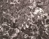 The Lake Haralson County Never GotUSGS · 1975 aerial photograph
- When the Tallapoosa Was Home
Share a photo, memory or landmark
Daniel reviews contributions before anything appears publicly.
Know someone who would enjoy this? Pass it along.